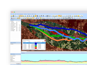
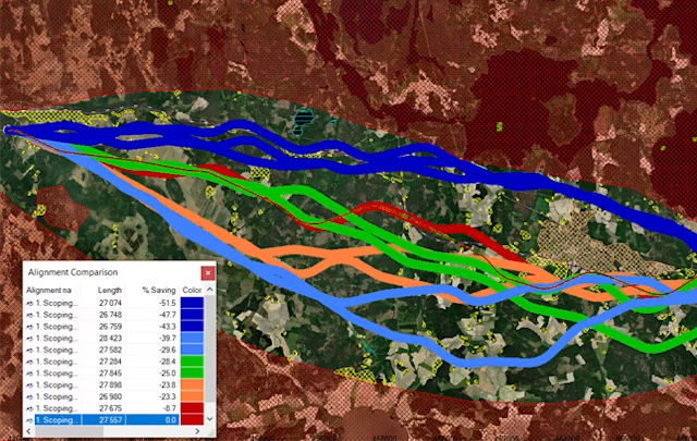
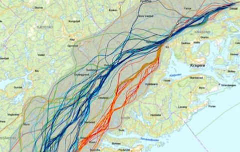
Corridor alignment is the earliest decision on a road or rail project and the most expensive one to get wrong. Trimble Quantm evaluates millions of possible alignments against your engineering, environmental, and community constraints at once, then returns a short list of the strongest options — so planners can compare real alternatives instead of defending a single hand-drawn route. Used from initial scoping through feasibility, pre-bid, and value engineering, it shortens the planning cycle and drives cost out of the corridor before construction ever starts.
Feasibility Planning
Before design begins, the corridor decision is already shaping your budget. Alignment analysis lets you see every viable path between two points and weigh them against each other — engineering constraints, terrain, cost, community impact — instead of committing to the first route that works. Trimble’s feasibility planning tools help engineers define and optimize corridors from A to B, then carry that plan forward into design, construction, and closeout without losing the reasoning behind it.
Optimal tool for both small road construction projects as well as large and complex road highway and high-speed rail projects.
Gather and analyze the existing situation, design standards, terrain, geological, and hydrological data, environmental areas and property ownership in one software platform.
.
Run all data factors along with cost information in a simultaneous optimization process on all types of rail and road construction projects.
Combines GIS data, unit costs, and geometric parameters.
Evaluate how noise impacts the community around the potential road corridor.
.
Plan for better environmental and public outcomes
The CO2 Calculator forecasts the carbon emissions a road or rail project will generate during construction — material haulage, land preparation, and structures — for each alignment under consideration.
It also projects the emissions traffic will produce once the infrastructure is in service. Evaluated across millions of alternatives, that gives planners a way to see the tradeoffs directly: what each route costs to build, what it costs in construction emissions, and what it will cost in operating emissions over its service life.
Features:
CO2 Calculator enables users to forecast CO2 emissions that will be produced in the construction phase of the civil project
Quantm shows a display of impacted traffic after construction project completion on the finished road
View daily traffic flow and average speed
Environmental impact on fuel consumption
Additional details showcase vehicle parameters
Noise indicators enables users to analyze how noise will affect the community around project
Reduce financial risk with alternative alignment transparency
Early-stage corridor planning is still largely manual — engineers draw and evaluate alternatives one at a time, and every option costs days of work. Quantm automates that process, generating and testing the full range of possible alignments so decisions come faster and rest on more than a handful of hand-built options.
Build your actual cost inputs into the analysis — earthwork, structures, materials, land — and the alignment comparison reflects real project budget rather than rough order-of-magnitude figures. The result is validated routes in a fraction of the time, and an optimal alignment you can defend with numbers.
Features:
Reduce investor risk and provide more accurate estimates for tightly constrained budgets
Insert all types of factors with accurate costs that affect the alignment of a construction project.
Factors that can be part of our feasibility planning software include the cost of structures such as bridges, tunnels, retaining walls, the cost of earthworks and excavation of different material types, the cost of expropriation of land, and the cost of road pavement or rail track and ballast
Reduce planning time
Trimble’s alignment software generates and compares thousands of corridor alternatives automatically, surfacing the strongest line without a single manual calculation. Validate road and rail routes faster, with an optimal alignment backed by the full field of options rather than the few you had time to draw.
Features:
Automate the alignment planning process with our feasibility analysis
Visualize true 3-dimensional optimizations to view proposed alignments in a real-life environment
Quickly assess multiple corridors and feasible alternatives in a short period of time to support the decision-making process
Export construction alignments to Google Earth
Weeks of alternatives analysis, done in days.
See what Quantm produces on a real corridor. SITECH Intermountain will walk your planning team through it.